About two years ago on the Urbanplanet.org site (which was the primordial soup from which Greater City Providence emerged and was born) I posted about trying to maintain a list of all of the public Squares in the city. The goal was to use such a list as a tool to promote branding of those neighborhoods. The city of Minneapolis, for example, has long latched onto the idea of giving their public spaces and neighborhoods strong branding to strengthen their city’s sense of place, identity, and retail activity.
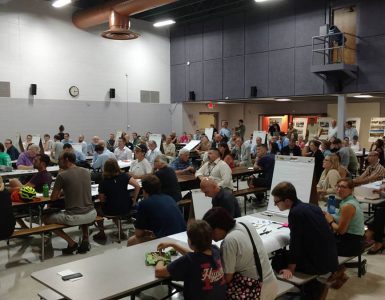
One of the last posts in that old thread was Matt’s suggestion that I put the Squares on a google map. Well, inspired by the work we’re doing to reboot Providence Station as Station Square (Part I here, Part II coming soon), that’s what I’ve now done. This map is right now very basic, just with the square name and location. With all of your help, I’d love to fill in details of history, activity, future plans, photos, etc.
There are many controversial squares I left out. Examples are Franklin Square, which is really now a historical curiosity with the 195 changes, and Randall/Moshassuck, which I’m not really sure exists anymore in recognizable form despite buildings present carrying those labels. Others do exist, but I’m not sure their names are in wide enough use to justify listing (Eagle Park Square, Odd Fellows Square, etc…).
I’d love help and feedback. Let me know in the comments section!


Great work, Bret! I know there are a bunch around my neighborhood. I’ll try and write them down.
This is great! However, there are signs around Eagle Park Sq that say “Eagle Park”. There’s even a Club Eagles (aka Clubbies for all you PC peeps). I’d say it’s used enough to warrant inclusion on that map, especially since it is a pretty major/important square and retail district for the neighborhood.
There are a bunch in my little neighborhood, but they’re all memorials to various people, and I don’t think they’re really used on a regular basis.
So Eagle Park Sq is technically the intersection of Admiral and Douglas, right?
Yes, that’s where it is. It’s pretty active, too.
I’d include all the degraded squares like Franklin, Randall, Moshassuck… Even if they are not square-like now, restoring their identity is the first step to remaking them as places.
Franklin Square especially is an important gateway to the Jewelry District and we should have the vision to see it reborn, even with the major impediment of the Iway ramps over it. I could see Franklin Square being the name of the southern RIPTA hub in the future.
I like the idea of having the “degraded” or “inactive” squares. Here’s the new color scheme:
BLUE = Active Squares. These are widely known as such with distinct retail, community, traffic, or pedestrian characteristics that distinguish them.
RED = “Degraded” Squares. These are areas that have historical references but either because of development, changes in the streetscape/neighborhood, or altered traffic flow can no longer be considered active, identifiable places.
YELLOW = Potential Squares. These are areas that have the chance, due to either pedestrian, retail, residential, or transit patterns to be planned and developed into active Squares with unique senses of place and space.
Luongo Square: Intersection of Vinton, Carpenter, and West Fountain on Federal Hill.
Is there a general definition of a public square that you are using?
Is the Eagle Square you reference on the map, the whole big square with all the stores, or does it reference the small corner of Harris and Eagle with the benches?
I think Bret at this point is just identifying were places that call themselves squares are. Regardless of if that is a larger place or just a point on the map.
Ideally, we’d like to see some of these square develop into larger places. Think the Squares of Cambridge, Harvard/Brattle is not just an intersection, it is an entire micro-neighborhood.
I personally feel that giving identity to a place is an important step in making that place attractive. Think if DePasquale Square was just, “that place on Atwells next to Venda.”
Luongo is already on the map :-).
As far as a definition of public square, it’s a tough issue… The previous debate was what is a plaza, vs a square, etc… Also making it tough is that the European definition of square in urban planning has tended to differ from the American version in the past. The European version tends to be a large central public space, often with a signature fountain or statue, plus or minus retail. The American version tends to be the intersection of several prominent streets, often without the large central space, usually with retail.
For Eagle Square, I chose the street intersection with the benches (I think… I have to go back and look at the map).
Decatur Square! although I suppose you have it covered with Luongo Square, but Decatur just has far more history. It used to be a real square, with a statue and everything. There’s been a lot of talk about bringing the statue back and building the square up again…
I always thought the European definition of a plaza was how Bret describes it, with the statue or fountain, and not necessarily a lot of retail, while the square had the retail.
I was always under the impression that it was DePasquale Plaza, not Square. Or is the square the intersection while the pLaza is the park with the fountain?
Jim, I think you have it right. I’ve seen references everywhere to both DePasquale Square and Plaza… I viewed it as you do… The Square is the intersection, the Plaza is where you sit…
Jen: Who was heading up the effort to get the statue back in Luongo Square and where is the statue now?
I know WBNA was involved, and the owner of the building the Decatur Lounge used to be in, and the planning dept. But I have no idea where the project is now. I’m sure the planners know…
Neat project. Surely one of the most colorful square names (that’s pretty much dropped out of usage but which was once common) is Turk’s Head. This is, as you might have guessed, right in front of the Turk’s Head Building. The name comes from a ship’s figurehead that was once displayed in front of a store in colonial times according to histories of Providence. I say we bring the name back.
Another square that has a sign posted is in my neighborhood, Elmhurst. Cunningham Square is at the intersection of Eaton St and River Ave at the main entrance to PC. Last year they (I assume PC, but maybe the city) re-engineered this intersection to remove a traffic island. Installed there is a granite marker labeling the square.
I’ll have to take a look at that area near PC… Some problems with “squaring” that area are that there’s no retail (or anything) there at all and isn’t that intersection, essentially, the entrance to PC with the gates? I’m presuming they (PC) named it after someone significant for the school… I have a hard time imagining that getting into more widespread non-PC use (why wouldn’t just someone say “go to the entrance of PC” rather than Cunningham Square?).
How did Eagle Park get its name? I know it is mentioned as Eagle Park Square, but why Eagle Park? Grew up there in the 1960s and it was the best. I will never forget the neighborhood and the relatives and neighbors who taught me much about life.