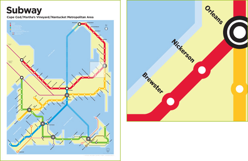
I love maps and I love transit and I love transit maps and I love this! Artists Rob and Damia Stewart have created a series of subway maps for locations across New England. Locations that are rather unlikely to see subway service anytime in the next century or two. In addition to the Cape & Islands poster seen above their maps include stand alone maps for the Vineyard and Nantucket; maps of Northampton/Amherst, MA (the couple’s hometown); and Manchester, VT.
18″ x 24″ prints of the maps are available on their website. I’ve already ordered the Cape & Islands one for myself and love that there is a Nickerson stop on the red line. 🙂
Via Boston.com’s Stylephile


I propose adding a stop at Cahoon Hollow Beach.
While subways for Cape Cod are a complete fantasy, some kind of interurban trolley system is at least plausible, and indeed many such systems existed all over the country. It might be neat to make modern-style maps of these long defunct systems, such as the one that ran from Providence to Bristol and Fall River. Maybe even make a couple of modern ad posters for it or something, and put it up in public places.
No stop in Cotuit?
There’s a Cotuit stop. It is on the gold line between Hyannis and Falmouth.
For April fools, a friend of mine designed for his site Cranston Style a pretty smart streetcar map for Providence.
http://cranstonstyle.com/Planning-Development/258/ridot-proposes-streetcar-system-in-providence
For an April Fool’s joke, that map is pretty darn good and would actually be a great idea…