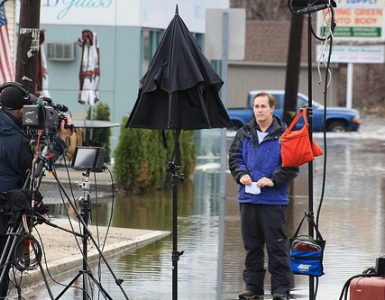
Video from WJAR-TV Providence, extended footage at WCVB-TV Boston
In the media we’ve been hearing a lot of talk about solutions to these flooding issues. People in areas prone to flooding wanting solutions from the government, etc. The fact is, there isn’t really a solution. If the Pawtuxet or other rivers want to leave their banks, they will.
But that does not mean there are not ways to mitigate the impact and severity of floods. Look at this table of the historical crests of the Pawtuxet River:
| Rank | Height | Date |
| (*) | 20.79 ft | 03/31/2010 |
| (1) | 14.98 ft | 03/15/2010 |
| (2) | 14.50 ft | 06/07/1982 |
| (3) | 13.68 ft | 10/15/2005 |
| (4) | 13.26 ft | 01/26/1979 |
| (5) | 13.11 ft | 04/25/1983 |
| (6) | 12.57 ft | 06/08/2006 |
| (7) | 12.40 ft | 04/17/2007 |
| (8) | 11.88 ft | 03/25/2010 |
| (9) | 11.86 ft | 03/31/2001 |
| (10) | 11.84 ft | 01/26/1978 |
Via: NOAA
Seven of the top 10 crests are in the last 10 years (the top 2 being this month). What is causing the river to flood so high now? I suspect that it is a combination of climate change and development in the river’s watershed. On the climate front, we just got 10 inches of rain in 2 days. That is obviously not normal. Will it happen again soon? Probably not. Thinking back over the storms we’ve had over the last decade, will it be another 50 or 100 years before it happens again? Maybe not. Climate change experts have been predicting larger, wetter storms for our region, and it certainly feels like those predictions are coming true.
On the development front, well, we here on this site quite like dense urban development. The key problem with the development patterns in the Cranston and Warwick areas is the dependence on the automobile is causing us to pave wide swathes of the landscape. That pavement prevents water from soaking into the soil and sends it all flowing directly into the river. Look at the video above, now look at this aerial image:

Image from Bing Maps
The river has nowhere to go, the mall parking lots just send the water straight into the river and when the river rises, it can’t soak into the land to dissapate the flooding. Head east and north of here and you see more pavement.
Another area the news crews seem to be liking to go to and measure the water is this Stop & Shop Shaw’s on Warwick Avenue:

Image from Bing Maps
There’s a parking lot right on the river. The question has to be asked, who approved this land use? The physics isn’t too hard, when you pave the riverbank, the water can’t soak in. It is not just the pavement along the river. The more areas in the watershed that are paved, the less land is available to soak up the water, and the more water heads into the river, causing it to rise. We have acres of paved land devoted to parking in the watershed, up and down Route 2, along Jefferson Blvd., Post Road, Pontiac Avenue…
So what is the solution then? We could just unbuild everything and turn it back over to nature. That is not terribly realistic of course, but not totally out there. There have been lots of residents who have been getting wet every year (look at the crest table again, then imagine you live next to the river), who seem to have had it. They want out, but they can’t sell their homes in the flood plain. Who would buy them?
Who indeed? Well, the Feds are set to give us a bunch of aid money to help homeowners and businesses recover. Many of these people though don’t want to rebuild, they see the writing on the crest table. The Feds should start buying these people out, and helping them to move, not helping them to continue to be flooded year after year. How many people are receiving their seventh federal assistance package this decade? Couldn’t we have just built them new houses with the aid they’ve received thus far, not to mention the aid they’ll surely need over coming years as the river floods again and again?
The towns need to change their zoning. Never again should a Stop & Shop Shaw’s or anything else with a giant parking lot be built on the banks of the river. The towns also need to look at parking requirements in the rest of the watershed. Drive up Route 2 and you see strip mall after strip mall, each with their own parking lot, each designed for maximum Christmas Eve capacity. These massive lots sit largely unused most the year, simply shedding water into the river. The towns should force developments to share parking lots and restrict the size of the lots. Also, parking lots need to have water collection systems such as bioswales that do not feed water into the river.
Aid packages can also be used as a stick. Warwick Mall is seriously damaged. There is standing water inside the mall. They are going to need substantial investment to get the mall up and running again. Should we make the aid contigent on the mall doing something to mitigate their parking lots? The mall could build a parking deck at the north end of their property and turn the lots on the southern end back over to nature. Engineer the land so the river can soak into it when it rises, which would mitigate flooding further downstream.
The Rhode Island Mall… well, isn’t it time we just get rid of the Rhode Island Mall? It is almost vacant, and has acres of parking doing nothing. It could also be turned back over to the river. A passive recreation area designed to flood when the river runs high. Yes, someone owns it and someone would need to be compensated to remove it, but let’s figure out a way to do that.
Better transit and better bike infrastructure will also help us reduce our dependence on autos and our need for places to park them. There is much employment in the area, but look at Jefferson Boulevard for example. Jefferson has acres of parking and has been heavily impacted by this week’s flooding. RIPTA Route 8, which serves Jefferson Boulevard, only has 7 roundtrips per day. How many parking spaces could be removed if bus service was more frequent to the area?

Photo by Jef Nickerson
And let’s not think I’m just picking on the suburbs here. Providence was not impacted as hard by the flooding, but the residents and businesses in the Valley Street, Eagle Square, and Kinsley Avenue areas will tell you we did not get away unscathed.
The Woonasquatucket is indeed very hemmed in by development and parking lots. The old Price Rite and Atlantic Mills in Olneyville, Eagle Square, ALCO, and more have paved land contributing to river flooding. Like the Rhode Island Mall, the old Price Rite could be removed and made into passive recreation land designed to flood. Bioswales and other catchements need to be built throughout the city to collect water before it reaches the river. And we should be giving serious thought to the residents and businesses of Tuxedo Avenue and Amherst Street. Do they keep flooding, or do we de-populate that area, or can other mitigation help remove, or at least reduce the flood threat? I’m not sure what the answer is, but we can’t keep bailing out, both literally and financially, year after year.


I’ve been around here for a long time and I don’t ever remember the flooding of the Woonasquatucket in Providence like we have now. And it’s always been developed land.
Tony, the flooding could be do in part to development upstream in the suburbs. After all, the water does flow south towards Providence. I honestly don’t know how much new development in the past 10 years has occurred along the Woonasquatucket, but if it has happened, that will surely cause more flooding downstream. I have friends in Greystone Manor in North Providence who got nearly 2 feet of water in the lower level of their apartments. I’m not sure if it was always surrounded by pavement, but the pavement goes practically right up to the riverbank there.
Tony:
The severity of the Woonasquatucket flooding (and all the flooding) of course has more to do with 10″ of rain following on the heals of 5″ of rain. In other words, it has much to do with the climate side of the equation. Though I have to agree with Jim, the city has been developed for generations, but lots of paving has happened in the watershed over the last half century that is a contributor to flooding and will make flooding continue to be worse than it has to be if the climate really is getting wetter (which I believe it is, but I’m not trying to get into a climate change discussion here).
If we want to avoid or mitigate this kind of devastation in the future, then we have to look at how we are developing the immediate riverfront and the watershed as a whole. We can mitigate a wetter climate if we build smartly.
Great post. Hopefully this gets heeded.
Jef, this was the post that made me realize that you’ve created a new genre of essay.
In your spare time, please write a book entitled THE NEW COGENCY: USING STATISTICS, CARTOGRAPHY, AND DIALOGUE TO MAKE BLOGS THE PRIMARY ANALYTICAL TOOL OF THE MODERN URBAN DENIZEN. I’ll buy a copy.
We need to look at development in different ways. We have too many impervious surfaces, we fill and build on wetlands, we remove native vegetation. Over time and multiplied, we see the results.
We are working to develop smarter here in South County, but we have had an uphill battle. Perhaps, after this flooding, our voices will finally be taken seriously and not as merely a road block to developers.
Nifty post, indeed!
The aerial shot of the shopping center built (and paved) in the heart of a loop in the Pawtuxet vividly demonstrates the point: we’re slowly paving over the suburbs with impervious substances. And the it’s only going to get worse.
A similar situation exists in New Jersey where the Willowbrook Mall was built in a loop of the Passaic River. Now it floods every year. The Corps of Engineers came up with a scheme to spend a quick billion on a tunnel to run flood waters down to the Newark Bay. Wiser heads prevailed, sort of: the tunnel never got funded.
It would have been cheaper by far to simply buy out the houses built in the flood zone (which didn’t habitually flood when they were built) and have a nice flood plain sponge — and, not incidentally, a park. But that didn’t get done, either. Next will come dikes to sluice the problem on down the river to someone else.
While I agree with pretty much everything being said about mitigating hard surface areas and development there is a more climatological explanation regarding the flooding events we have seen.
While I couldn’t access free data on the NOAA site beyond 1999, those early Pawtuxet flood crests were tied to double digit rainfall. June 1982 – 11 inches of rain, April 1983 – 12.5 inches of rain, January 1979 – 11.5 inches of rain. There were also significant “rain events” of 4 plus inches during those months. I also remember the rainfall from October 2005 since i seemed to be continuously pumping my basement that month. When you get that much rain in that short amount of time even a more porous watershed is not going to hold all that water. Flooding is inevitable.
Unfortunately, the flooded areas being shown on the news are located in 100 or 500 year flood plains. Most of the Warwick Mall, the Stop and Shop on Warwick Ave and the flooded areas along Valley St at Eagle Square sit in flood plains. Its not a question of “if” these areas flood its a question of “when”. 16 inches of rain is pretty much going to create a “when” condition. Whether or not higher rainfall totals is a climatological coincidence or the result of global warming is a hot topic (pardon the pun) that is being debated everywhere.
In the end, the only sure way to protect buildings in a flood plain is not to build them. Baring that you have to build (or rebuild) them so that habitable areas and critical services are constructed above a designated high water mark and that the sub-structure holding those areas up can withstand the pressure of a fast moving flooded river.
I would suggest the Lando Calrissian solution. No floods in Cloud City, baby!
I have heard through a very tangled grapevine (AKA take that for what it’s worth) that there is a good chance that the insurance company may decide to potentially render the Warwick Mall a loss. Please note the hedged wording here is intentional. I think this is based on adjusters merely looking at the outside damage and not actually doing much of an assessment.
Still, the point of where I’m going here is if the Mall is deemed a loss, my guess is that we will get a bigger mall in its place with the insurance money. And maybe more parking.
Sure, development within a flood plain will flood. The point is that the way we shape our rivers, banks, and watersheds affects the severity and intensity of flooding. Do local and/or state building codes, for instance, require development near rivers to mitigate storm water completely on the property? That is, any run-off from the the property after development should be the same as before development.
If Warwick Mall were to be rebuilt from scratch, they might consider elevating the entire building on piers several feet above the newly established high water mark, so that future flood waters could flow under the building. They could augment parking with some multi-level garage structures.
Another result from the flooding could be stores relocating to the lackluster Rhode Island Mall since its two levels seemed to escape Warwick Mall’s fate.
I’m not sure why they would re-build a bigger mall in its place. It’s not exactly a great mall to begin with. They could easily fill the RI Mall with those stores and maybe make the anchor stores stand-alone, tearing up some of the pavement along the river to help mitigate some of the future flooding (because it will happen again).
And I’m not sure where more parking is gonna come from. The place is already paved out. The only way to add more parking is to build a garage or build a smaller mall.
Jef, great post, but I want to correct you on one point. It was actually a Shaw’s that got flooded on Warwick Ave in Warwick, not a Stop & Shop. That said, the City of Cranston has approved the construction of a Stop & Shop diagonally across the street & river, on land that is now a tree nursery (which was also flooded). The City needs money (who doesn’t?), and so the City Council changed the zoning laws to enable the Stop & Shop to be built (along with a parking lot with 50 more spaces than required by the city. There’s still a number of reviews going on by the RIDOT and others before this can proceed, but so far it has seemed like a done deal. Perhaps the flooding will change some minds. More info here:
http://www.friendsofthepawtuxet.org/#StopShop
Thanks Tim, I edited the post to reflect that it is a Shaw’s, not a Stop & Shop.
Also, speaking of rolling back riverfront development, did you see this Projo article from last week about Belmont Park in Warwick, which is right across the Pawtuxet from Perkins Ave (Cranston), which was also featured heavily in the flood coverage?
http://www.projo.com/news/content/Belmont_Park_03-24-10_KNHSK6U_v11.36e5924.html
DEM has some pretty clear requirements regarding installation of detention basins to hold runoff. I am not a civil engineer so i don’t know if the regs are meant to detain 100% of the run off but the calculations include factoring in all impervious surfaces (not just the parking lots) and use water volume and infiltration rates back into the watershed to determine how big the basin(s) should be. Analysis also has to include the impact of 2 year thru 100 year storm events on the system.
I would think that new or more recent developments probably have better detention and slower infiltration numbers than older ones. Not saying that means we should just pave away just that we have gotten a little smarter with figuring out what needs to be done. Unfortunately, some of the biggest culprits for water runoff are probably city and town storm drains (especially the combined systems).
On a positive note it seems that the Phase I of the Providence combined sewage\stormwater overflow system kept up with the water pretty well even though it wasn’t designed for a storm event of this size. Waiting for NBC to give put out a final report on performance. Hopefully, the recent flooding will stress the importance of continuing on with Phases II and III.
I read that journal article but forgot the name of the park so i couldn’t look it up. The Riverside Gateway project in Olneyville also shows that you can balance open space and development along a river in a way that benefits everyone.
http://www.rilisc.org/Projects/RiversideGatewayProvidenceRI/tabid/154/Default.aspx
Good article about what Vermont is doing to mitigate flooding.
It is a long article, but worth the read.
I completely agree with getting rid of federally subsidized flood insurance. Not only on rivers but coastal areas as well. The first step would be to just stop writing any new policies for building on undeveloped land and for major improvements to existing structures (ones that substantially increase the assessed value).
UNH study shows increasing trend of heavy rain events in the Northeast. Linked to climate change.
Seacoast Online
As I’ve said repeatedly everywhere, it’s insurance companies right now that are driving the climate change discussion. And our recent troubles won’t do anything good for their peace of mind. These “100-year” and “500-year” flood phrases are just that – phrases. In Fargo, ND, the 100-year flood is an annual event. Historically-based actuarial risk management calculations simply no longer apply.
Dan, where you suggest eliminating the federal flood insurance program, I don’t think you have an appreciation of how many buildings would be affected. In most areas, they are the sole provider, so absent them there is nothing. It’s lots and lots and lots of houses and buildings. (I’m not sure there’s a subsidy involved. In the few markets where there’s a private competitor, private (because they can exclude highest risk) can offer a lower premium than the G.)
Jef, I hope you’re right in that we won’t see rain like this again any time soon, but your last comment speaks clearly to the continuing trend of greater numbers of larger, wetter storms with lower lows at their centers. Compared to the midwest, we’ve really lucked out over the past decade, chart at the top of the page notwithstanding. It could have been even worse. And likely will be.
“we fill and build on wetlands”
Deb has the best and correct answer. Growth advocates have devalued the term wetlands.
“A wetland is an area of land whose soil is saturated with moisture either permanently or seasonally. The USA came to understand how biologically productive wetlands are, so the USA passed laws limiting wetlands destruction.”
Local zoning and DEM are constantly bullied to allow fill and development of wetlands and where wetlands are undisturbed, major construction is allowed far too close to the wetland site.
It’s a disgrace but money always wins. You reap what you sow.
There is no disagreement that wetlands should be preserved. DEM is a formidable agency. There have been property owners who’ve been denied access to their land due to minor wetland along roadsides and the agency isn’t bashful giving large fines to various violators.
Warwick Mall was opened in 1972. The origins of DEM date back to the mid 19th century to protect fisheries. Particular understanding about inland wetlands wasn’t fully understood until the mid-late 20th century. Note the North American Wetlands Conservation Act was enacted in 1989. Despite the first Earth Day in 1970, the environmental movement didn’t really get into full swing until the mid-1970s. The clean water act wasn’t approved October 1972, six months after Warwick Mall opened. It’s possible that the Warwick Mall developers bullied regulatory agencies, but were there any regulations in place at that time to protect inland wetlands? The general attitude at the time was that inland wetlands were swamps. The primary focus then was on saving estuaries.
Since Warwick Mall land was trashed over 38 years ago and has been responsible for a significant amount of retail economic activity in the state, a more constructive discussion might be how to get the facility repaired and functioning again. It’s worth bringing up how it might be possible to recreate some wetlands on the site, but who would pay for it?
My comment on eliminating Federal Flood insurance was probably too brief. I am aware of the millions and millions of dollars tied up in property receiving this type of insurance. I feel though the rules pertaining to the risks have to be reevaluated. A first step would be to seriously reconsider insuring any undeveloped land lying within the current 100 year flood plain – which I admit is now probably more like a 50 year plain at most. The next step after that would probably to look at all claims filed in the face of natural disasters and see if its more feasible to just buy out the owner instead of paying to have them rebuild in the same spot. If climate change is responsible for a lot of the destruction its bound to happen again and more often.
With regards to the Warwick Mall…The mall and it’s parking lot were built before the requirements for on site rain water retention. I can’t see any in the aerial photo. It may be possible to retro-fit some of the parking areas for basins that will mitigate the impact of run-off.
WPRI reports that FEMA is only buying 1 of 37 Cranston homes in the flood zone that sought to be bought out.
Flood victims to get little FEMA help: wpri.com
A start…
RINPR: Feds to buy Cranston homes flooded in 2010
Now, these homeowners will finally stop having their lives ruined every few years that the Pawtuxet decides to leave her banks. And insurance companies and FEMA will stop throwing good money after bad trying to make them whole each time it happens.
There’s still much more de-paving and other things we should be doing to reduce the frequency and severity of flooding, but this is a start and good news for these homeowners.
Bravo, I guess it’s never too late.
Jeff – Please contact me about Olneyville lime houses photographs. I’m researching the Barlowski family for my dissertation from 106 Delaine by the river. They lived in the house closer to the bridge as you face the houses. Please let’s talk! Best, Karl
Great stuff you do for Providence, BTW.