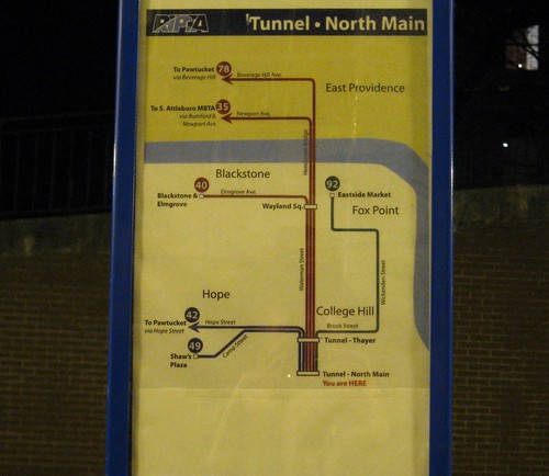
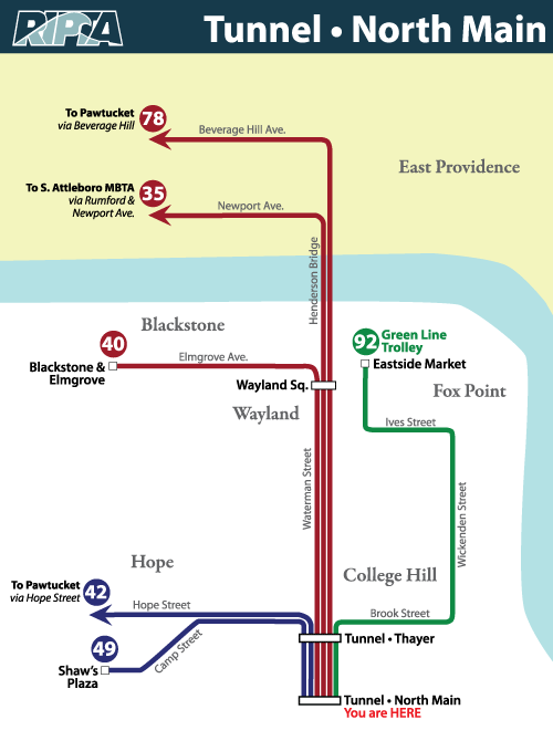
Way back in February I wrote about the need for a map at the bottom of the bus tunnel to tell you where all those buses zooming through it are going to. I even doodled up a little map as a suggestion for what such a map should look like.
When RIPTA contacted me the other day to let me know they were hanging a map, I was pleased. When I went down to check it out last night, I saw that it was my map they hung. 🙂
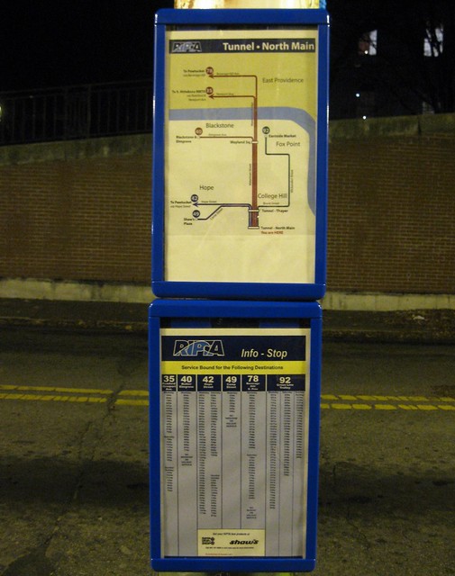
Along with the map, they’ve hung a handy schedule.
Now I think I might should get to drawing some more maps.


It’s a Christmas miracle I tell you!!!!
How about a map in downtown on Washington Street right next to Lupos that chronicles where all those crazy buses go?
Or by the mall?
Awesome!
I think it would be nice to have the maps also show neighborhoods/destinations, and if the bus destinations are the same (42 and 78), it might want to show that.
How much you get paid to make maps?
Yeah, seriously. I hope you got some compensation.
One thing this does point out, though … the tunnel and Thayer are well served by transit …