
While we’re waiting for Sandy, let’s look at some photos. First up, this image of Sandy herself (himself?) from NASA:
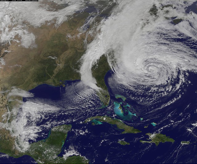
Photo (cc) NASA Goddard Photo and Video
NOAA’s GOES-13 satellite captured this visible image of the massive Hurricane Sandy on Oct. 28 at 1615 UTC (12:02 p.m. EDT). The line of clouds from the Gulf of Mexico north are associated with the cold front that Sandy is merging with. Sandy’s western cloud edge is already over the Mid-Atlantic and northeastern U.S.

Photo © Ken Zirkel.

Photo © provbenson2009

Photo © Jerri Moon Cantone

Photo © photobrien81

Photo © provbenson2009
Share your photos with us on our Flickr Group or email them to contact@gcpvd.org.


Add comment