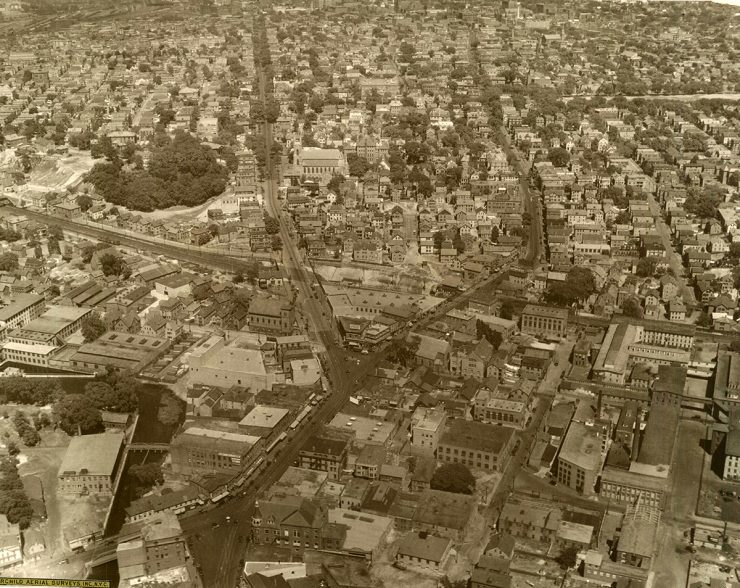
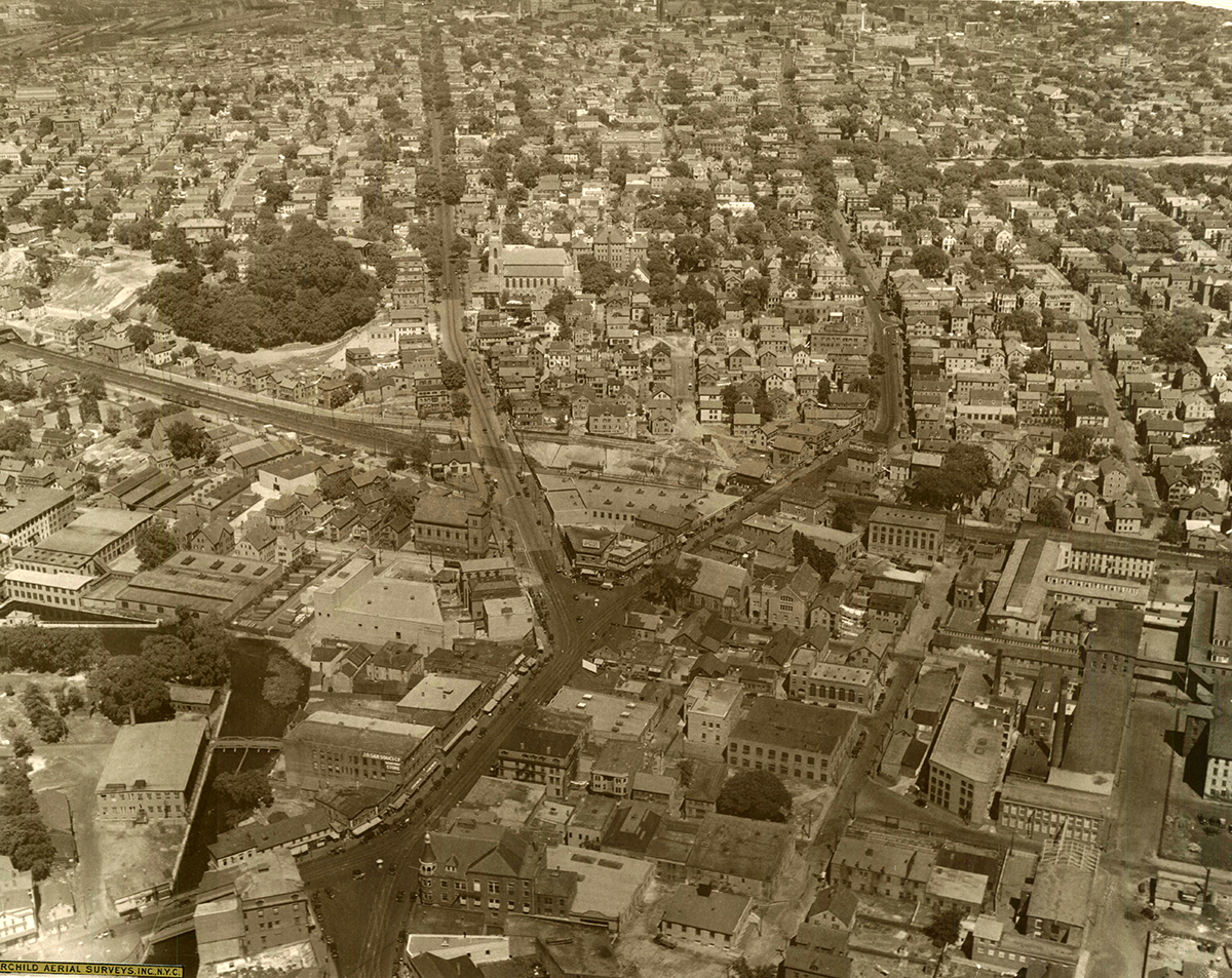
Olneyville before the construction of the 6/10 Connector
In the report released Jan. 22, VHB estimated that between 7,000 and 9,000 people use mass transit to reach downtown Providence from an area south and west of the city and could utilize a 6-10 transit line. The higher end of the estimate, 9,193, came from adding the passengers of 13 current Rhode Island Public Transit Authority lines and the 7,014 figure came from extrapolated census figures.
[…]The additional 3,500 to 4,000 riders VHB estimates would use a new transit line on Routes 6 and 10 was determined by taking these numbers and adding “several percentage points” of higher transit usage to the population within the catchment area.
That all sounds rather, take a guess from this column and take a guess from that column, but OK. It seems like RIPTA needs some input on this. Do existing lines from the south and west get re-routed? Does that allow for better time into the City? Does that attract more ridership? Is there a demand for riders from the south to reach Olneyville without making a transfer in Kennedy Plaza and vice-versa..?
Details about what a rebuilt 6-10 interchange would look like are also unknown, with Department of Transportation officials saying they intend to turn at least part of the limited-access highway into a surface-level boulevard, but not how much of it.
That is somewhat encouraging.


A few things to keep in mind:
*The City of Providence added an item to the TIP (Transportation Improvement Plan, I think, is the acronym) for a boulevard-like 6/10. When I spoke with officials at Planning, they were unclear of what that meant exactly, and phrased the choice to not call it a boulevard specifically as a political hedge not to cause controversy (so people should call them and cause some controversy: we need a boulevard). In any case, I haven’t seen the plans as they exist, but I know that there’s at least some kind of item that has positive elements.
*Another item is still there, which is a rebuild of 6/10 as is. People should call their state reps and senators and ask that the GA push RIDOT to take that item off the TIP entirely.
*I think the key feature has to be pedestrian-friendly infrastructure around the bus stops. So people should keep an eye out to whether the city and state do a good job of planning that. The bus lanes alone are not an advantage, unless they have good passenger access, biking, walking, and development land around them.
*Another thing to keep on top of is how many lanes this thing gets. We’ve proposed 2 lanes for cars, 2 for buses, a bike path, and (if needed) a center turn-lane for cars. Having fewer lanes would actually help the design, because it could either be set up with limited to no signaling, or could have signaling that prioritized bike and bus through traffic (which is straight) over car traffic. Philadelphia’s 20 mph light cycles would be a model, or someplace like Poynton in the UK with its focus on non-signalized intersections would be possible too. With more lanes that option goes away, and the project loses a lot of its appeal.
*The city is planning meetings for public input for early March, and they will happen (I’m told) somewhere around Olneyville. The dates are not set. Initially, we wanted meetings set for fall, and Providence Planning put those off at the request of RIDOT. RIDOT then declined several times to participate in this last round of meetings, although I’ve heard that recently changed and RIDOT is communicating with the city again. So please keep your eyes peeled for public meetings. A good person to contact if you want to be informed of upcoming stuff is Providence Planning, and Martina Haggerty would be the best contact.
Bus lanes on 6/10 were not in RIPTA’s strategic plan wish-list, as it didn’t seem they were needed.
It sounds like the “consultant” was stretching to make the numbers seem large, but I suppose its best to study the report before making firm conclusions. Need to consider why south county buses should use use the slightly longer Route 6/10 corridor instead of I-95 and how they counted local westside routes thru Olneyville routes such as 17 Pocasset-Dyer 18 Union, 27 Manton, 28 Hartford Ave, which together also provide high-frequent services on either Broadway or Westminster. We’d need to see a service plan so those avenues are not skipped, even if some of these west side lines ran express somehow – it should be noted that scheduled trip times from Olneyville to KP range from about 10 to 15 minutes, so there isn’t that much potential time savings by running express on 6/10, less if there are bus stops on any “boulevard” there.
I think that is all separate from the boulevard issue which can help reconnect the city, free some land for redevelopment, better accommodate bikes, even if it slows some suburban car commuters and causes little change in bus service.
A bus lane on Route 6 west of Olneyville is ludicrous where there are only about 6 or 7 buses/day each way weekdays only going out towards Route 295 that way, and little potential demand for more transit. This can only be to game the Federal system.
With $2 and these ridership estimates, I can go get a large coffee at Dunkin.
I absolutely agree with Barry’s assessment that this is about extracting money from federal transit sources for the kind of “transit” that can be easily converted back into general traffic lanes with no delay later. It’s worth nothing that even as we ask all these questions about the shape of a boulevard or “boulevard-like” replacement for the 6/10 connector, the elephant in the room that has yet to be addressed is the high-quality rail transit corridor already in place adjacent to the freeway. It’s imperative, absolutely vital that space for four unbroken mainline tracks is preserved here – any boulevard plan that would encroach upon the rail corridor or prevent it from growing to accommodate future regional and intercity traffic ought to be rejected out of hand.
I’d suggest that if there’s anywhere to create a dedicated busway, it would be along Broadway where the ridership is now, and not on 6/10 or whatever future boulevard replaces it where some ridership might possibly maybe materialize later at numbers significantly lower than what’s been “estimated” officially. (I’d suggest that a busway on Broadway should be built with future potential conversion to light rail or better in mind, but that’s neither here nor there.)
I’d also suggest that if the city, state or region want to demonstrate serious commitment to a robust transportation network, a number of excellent plans have been proposed for regional/commuter rail in this area both on this site and elsewhere in the community. The time to begin acting on plans like Peter Brassard’s RI-TRAIN is now.
I agree with aspects of what Ryan and Barry said, but not all of it.
Barry’s right that 6/10 bus lanes would be of little utility given our present situation, but the key difference is land use. Once there are seventy acres of new land open, though, there will be a need for a route to accommodate that new land, and to preempt parking. The BRT-style of the route is especially important, because what will draw people to locate there is the mobility advantage. Barry points out that other avenues shouldn’t be skipped, and I agree. But there’s quite a distance (and steep hills) from Atwells or Smith St, much less Broadway, so if there’s going to be development along 6/10, it needs its own route. I also think the point of bus lanes is only partially speed: the big gains are also in operational advantages from the ability to turn the route around repeatedly. You could eventually envision the 6/10 bus route continuing east along 195 bus lanes, or even a Waterman/Angell bus lane pair, to EP. I also think the bus lanes are vital for pedestrian and bike friendliness, in that we want slow car speeds but effective transit. If we had five or ten minute headways on the BRT, having it zip through at high speed wouldn’t harm the pedestrian feel, whereas trying to create a road without congestion in order to create bus mobility would.
The boulevard does not impede on Amtrak/MBTA, Ryan. The right of way we called for is 120′ wide–which includes lots of landscaped medians, two car lanes, two bus lanes, and a four meter wide bike path–and that still leaves space for buildings or parks in even the narrowest sections. Alon Levy spoke of the possibilities of four-tracking MBTA, and although there are no immediate plans for that, we should jeep it in mind. The BRT plan is also the option we chose because of the lower capital expenses, but we’ve advocated for a rail upgrade if ridership calls for it (at lower operational cost). The gradual approach is designed to draw wider political support.
I think we should be suspicious of RIDOT, but over time my suspicions have changed. I don’t RIDOT could put bus lanes down with federal money and then remove them as a bait-and-switch, even if it was so inclined. I’m sure that would immediately cause the money to be rescinded. What RIDOT *will* do is try to add car lanes above and beyond the two that are needed, make signal times set to higher speeds, have bike paths or bus lanes without proper signal priority over cars, or make lane widths for cars wide enough to cause speeding. That will have a negative impact, and that’s the thing to watch out for. And these concerns I have are political: I think that alviti and especially Garino are transit and bike positive, from the interactions I’ve had, but are not willing to risk anything beyond what is the consensus of the public. So let’s get out and form that consensus: we want not just any old boulevard, *but the best kind possible*.
As they say, cawwwl yer representatives. 😉
James, it concerns me when the official plans don’t acknowledge the rail corridor and the advocacy releases barely do.
I make mention of the fact that the rails are there right now because that means the calculus completely changes on capital investments versus in a situation like on the East Side (where the infrastructure is abandoned and completely disconnected from any existing network) or along the East Bay (where there’s little to no infrastructure to support rail at all). Instead of talking about a 120′ corridor, we should be talking about a 180’~200′ corridor – the roadway, and the railway, as a complete unit instead of two distinct parts. And once we start treating the entire transportation infrastructure corridor as a single unit, it becomes a matter of shell stations (the same quality of station that BRT would get, so a net zero cost comparison) and a single additional track (bumping us up to four) versus the cost of paving two additional lanes built to BRT standards. The capital investment probably looks a lot closer to neutral here, so I think the case can be made a lot more effectively for rail now instead of rail maybe-later-maybe-never.
I have little faith that the final product for whatever pops up in the wake of 6/10 is really going to be limited to one general traffic lane in each direction. I’d consider it a great victory for sustainable road design if we kept it down to two each way and a turning lane. That, on top of a busway, on top of the landscaping, on top of reclaiming developable space and it’s starting to look like we’re running out of room. When we run out of room and if we’re not treating this is a complete corridor, that’s where we open ourselves up to problems like encroaching on the railway and where disasters like the Hartford Busway are allowed to happen.
And yes, I have called my representative.
Two lanes for cars with a turning lane would be wider than Memorial Blvd, without considering any room for transit, biking, development, etc. I think that we need to be clear to our representatives that no more than two cars lanes (maybe with a turning lane) are needed, because otherwise what we’re advocating for is a stroad.
I am not a member of the Transportation Advisory Committee, but Jonathan Harris of our team is. I attended a meeting today and mentioned my thoughts on four-tracking MBTA along the corridor, and said that I thought that 6/10 needs to be thought of in terms of its potential to make the Central Falls/Pawtucket (and eventually, Woonsocket) train station plans more feasible. One of the things that is discussed a lot with those projects is the disconnect between planning goals and actually being able to implement something, with a big emphasis being the problem of sharing track space with MBTA/Amtrak. I can’t really expect people to listen to me, but I am trying at least to bring these thoughts up. Keep pushing, because I agree with you about the rail potential.