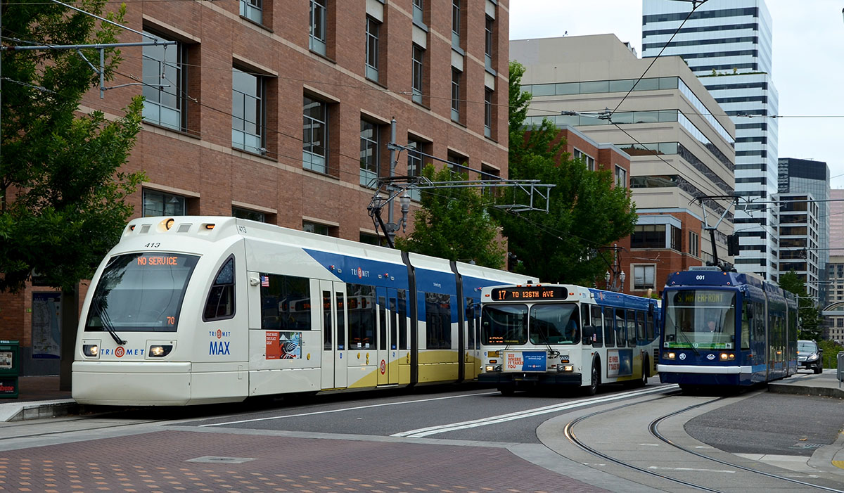
Max light rail, bus, and streetcar operating in the street in Portland, Oregon. Photo (cc) Kevin Zolkiewicz
[alert type=”warning”]This post was submitted Greater City Providence reader Peter Brassard. If you’ve written something you’d like us to consider posting, please contact us and let us know.[/alert] [alert type=”info”]This is fourth of a series on ideas for Rhode Island’s transit future.[/alert] RIPTA’s bus hub proposal and bus rerouting for Downtown Providence will produce headways (the time between arrivals) of two to six minutes. Headways for the streetcar are proposed to be ten minutes and the streetcar path would mostly duplicate RIPTA’s proposed Downtown bus route trunk lines.
With RIPTA’s planned improvements, does the streetcar proposal make as much sense now? How might the streetcar or light rail route be modified?
There are officials, members of the transit advocacy community, and the public, who suggest that Rhode Island might only be able to build a Bus Rapid Transit (BRT) system. Creating a BRT system covering most of the urban core would be a tremendous improvement that would complement the existing bus system. However, BRT could be reaching for the low bar and forfeiting greater benefits. Rhode Island might do better and BRT should be viewed as just one option. For this discussion, I will be proposing light rail, but it should be understood that light rail and BRT are interchangeable.
Another idea, instead of the current two-mile long streetcar route, would be to upgrade the seven-mile long R-Line to light rail standards, preferably extending it into Central Falls and to TF Green Airport. Since the R-Line weaves through downtown and assuming that the project is built as rail, existing TIGER grant requirements should be satisfied.
In addition to the R-Line, a second route should be part of the plan. It could originate from the eastern, more urban part of Johnston to Olneyville Square to Downtown through the abandoned rail tunnel to East Providence terminating in Riverside.
Many will argue that buses are cheaper than light rail, which is true, if viewed as a short-term initial investment.
In the mid-1970s when Portland, Oregon considered what today is their light rail system, it was assumed that buses would be used. The following factors were cited in favor of choosing light rail:
- Operating savings: Each light rail car can carry over 200 passengers, doing the work of four buses. Therefore, operating in two-car units, on eight-minute headways, each would do the work of eight buses, while driven by one operator. The equivalent buses, traveling at one-minute intervals, would create bus bunching, while requiring eight operators.
- Long-range savings in capital costs of vehicles: Although a light rail vehicle costs far more than a bus ($4 million in 2008, as compared with $300,000 for a bus)—in doing the work of four buses, the light rail vehicle would actually save some $3.2 million in bus purchases over its 30-year life. This is because the bus will last 14 years at most, and 14 years of inflation between bus purchases must be considered.
What was not considered in the Portland analysis from the 70s, were today’s gangway light rail vehicles and articulated buses, both having greater capacities. However, there remains the operational and capital cost savings with light rail vehicles.
Because rail vehicles are reliably guided by their tracks, they require a minimum width of right-of-way (ROW). This makes surface light rail especially appropriate and considerably safer for streets with many pedestrians. With rail, the ROW can be of minimum width, unlike with rubber tire.
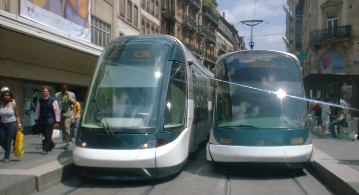
Light rail trams on the streets of Strasbourg, France. Photo (cc) michallon
The rails provide a smoother more appealing ride. ADA compliance is much easier to achieve. The combined effect of platforms meeting the vehicle floor level allows for narrow gaps between vehicles and platforms, so there’s uniform accessibility to all vehicle entry doors. The dedicated and self-enforcing path of light rail cars discourages motorists from entering or delaying the transit line, resulting in reliable trip times.
Speed is the missing critical factor for most of Rhode Island transit. The main problem with bus transit within Rhode Island’s urban core cities is lengthy travel times, so transit can’t compete with driving in most cases. Light rail can be faster than convention bus service, if it’s located in a separate right-of way not mixing with car traffic. Priority treatment should be given to light rail (or BRT) over other travel modes.
BRT when it’s within a highway right-of-way or commuter rail lines often will have stops that are far apart. By contrast, light rail that operates in a full or partial exclusive right-of-ways on surface streets within established neighborhoods, can have more stops to serve a larger population. To be successful, light rail needs to be situated where there’s the most demand, where people live and work. Rail corridors and highway BRT doesn’t reach as many people or not directly.
Generally Providence’s urban core has constrained street widths. It’s impossible to provide an exclusive right-of-way for an entire route that uses city streets. An alternate might be to have only parts of a route within exclusive right-of ways.
Selectbus service in New York City operates in exclusive lanes with off-board fare-payments. Photo (cc) New York City Department of Transportation
With an R-Line route it’s possible to eliminate one car travel lane in each direction on North Main Street for an exclusive right-of-way. Years ago Broad Street south of Trinity Square was four-lanes and currently most of Warwick Avenue and Post Road are four-lane, so it’s possible to create segments of exclusive right-of-way along these streets.
For the east-west route exclusive right-of-ways could be built on a new boulevard between Olneyville and Downtown, the rail tunnel, and a few sections in East Providence.
One reason why the Providence Streetcar is unpopular with many and has received limited support, is that since the beginning there was no larger vision for how the system might expand. The recent streetcar proposal has started to indicate potential extensions. The Transit 2020 study looked that light rail among many modes of transit. Ultimately decisions were made to pursue the streetcar project instead of light rail or something else that would serve more of the population.
Over a half million people, half of the state’s population, lives in the six cities and one town that I proposed could have light rail lines. In order to get political support for a major infrastructure project, such as a light rail or a BRT project, to succeed as many people as possible need to benefit from it.
If lower density cities like Portland, Austin, and Salt Lake City can develop robust transit systems that have light rail as the backbone of their systems, there’s no reason why Rhode Island, the second most densely populated state, can’t do something similar or better.
A grand transit vision for the metropolitan region needs to be developed and articulated. Whether it’s a PRO-TRAM light rail or BRT on city streets, or better utilization of the existing Northeast Corridor for instate train service with multiple infill train stations, government leadership must step up to the plate on transit. The Governor should rally the Mayors around a new grand transit vision.

I would add to the right-of-way to include parts of downtown. It’s true that some of those streets are not wide enough to allow exclusive right-of-way and cars, but then some streets could simply be no car zones. If the R-Line as rail continued on the existing route pattern, I think Exchange Street (the north/south one) could certainly be bus/rail on two lanes, and bike on the remaining parking-lane space. Empire is definitely wide enough–to my eye, Empire is a borderline stroad, architectural beauty notwithstanding.
Another interesting option could be using filtered permeability. That could be used, perhaps, on Prairie Ave. I’m not sure if locating the rail off of Broad would be too impractical, in terms of land-use around it, but I think a semi-exclusive right-of-way for rail/bus on Prairie using filtered permeability (to allow only residents and deliveries) would bridge the gap. And the hospitals are viewed as an important streetcar stop, so perhaps TOD could be oriented along that route by using the filtered permeability system.
I actually have come around on rail. I was a big and loud proponent of BRT, but the operational costs are really important. I think you bring an important perspective here by pointing out how important it is for any route, rail or bus, to have exclusive rights-of-way. Having a streetcar or light rail will only make sense with those features.
I’m not sure I support going all the way to the airport. Maybe the disinterest comes from the fact that I don’t fly, but it also comes from an interest in frequent core service, and even with a ROW I worry that extending into Warwick is too far. The Route 1 bus has this problem, going all the way from S. Attleboro to Warwick Airport, and as someone who lives a stone’s throw from what could be a really frequent route along Hope St., it bugs me how much capacity is taken to connect to these endpoints. I guess I wouldn’t make it Custer’s Last Stand or anything, but in general I think our system suffers from too many costly extensions outward into unproductive suburban sprawl, that hurts operational efficiency. If we did try to extend to the airport, I would think doing so just by increasing operational budgets for the MBTA service that exists would make more sense than duplicating the endpoint yet again with another route.
I’m totally for a light rail option. Especially for transportation to airports. Not everyone in the state is from RI, there are many people who have family and friends outside of the state who travel frequently. As well an many that travel for business purposes. It’s currently so inconvenient to take the bus to T.F. Green. I rarely do it and tend to fly out of Boston more often because it’s more public transportation friendly.
Was there any discussion about a light rail route to South County? The 66 bus route is awful, especially in the summer. I live in Providence and work in Peacedale. It currently takes about 2hrs to commute by bus from Providence down to South County. And there isn’t an express option leaving from Providence like there is for the Wakefield south county folks. I’m originally from San Francisco, lived in New York City for 5 years and in the Washington DC area for 2 and half years. I’m very familiar with public transportation and would love to see Rhode Island operate like a major metropolitan city.
It’s time for bike-share in South County.
http://transportprovidence.blogspot.com/2015/12/born-on-fourth-of-july.html
We need a fifth in this series, about the need to replace the 100 year old hub and spoke system with an entirely redsigned network of bus routes.
Connecticut’s 9.4-mile long CTfastrak BRT route cost $576-million, or roughly $61-million per mile.
Proposed 1.6-mile long Providence Streetcar cost are estimated to be $100-million, or roughly $62.5-million per mile (and located completely within a dense urban area, unlike CTfastrak).
Worth noting that CTFastrak will absolutely be torn down in under 30 years – part of it is in the way of adding tracks to the New Haven – Springfield corridor (and Amtrak has a permanent easement to take back its space whenever it decides it needs it), part of it is in the way of absolutely any option for dealing with the Hartford Viaduct that isn’t repair-in-place (including just demolishing it entirely), and the part that’s left over won’t connect anybody to anything and is liable to just be demolished as a matter of course.
That busway is in absolutely no way a good project.
Providence could pay for a massive streetcar project connecting Brown, RISD, RIC, PC, URI, RWU, JWU to the downtown (and each other) if it just made these businesses (because that’s exactly what they are) pay their actual property taxes. Brown would owe $38,000,000 per year, alone. Let’s assume all the others just add to $12,000,000 total because I don’t have all the data. $50,000,000 in annual revenue not collected.
They could put in their phase 1 plan (1.6 miles) for: $100,000,000.
Phase 2: Train Station to Olneyville Square via Broadway (1.9mi.): $119,000,000
Phase 3: Train Station to Brown (Thayer) (0.7mi.): $44,000,000
Phase 4 could connect both RIC and PC at the same time if the streetcar line followed Smith Street (44) to LaSalle Academy area, which is about 2 miles. Both schools could then do surface road and sidewalk improvements to get students from the station to campus, and minimize the effect on the abutting neighborhoods. Cost would be $125,000,000 using the same cost per mile assumption. Eventually, the original line to the hospitals would/should be extended to the JWU Harborside Campus. JWU could completely eliminate their WildCat shuttle between the campuses.
Of course, some of these costs would be shared, so this is a high side assumption, but for $344 million, it would only take six years of these college property taxes, not counting any fare revenue or advertising revenue. The colleges would be linking their campuses to the capital city which would make these schools so much more attractive, especially RIC and PC.
This is such a no-brainer. Actually tapping the economic benefit of these college populations, adding massive infrastructure, and monetizing the universities simultaneously. The campuses will become nodes in the Providence educational/institutional network, it would be a clear signal that the City is open for business.
Streetcars that have short routes that mix with car traffic are NOT the same as Light Rail Transit (LRT) that have long routes that travel in mostly exclusive right-of-ways, which connect larger population areas.
Less successful Streetcar projects: Dallas, Atlanta
Highly successful LRT projects: Hudson Bergan Light Rail in New Jersey, Portland, Seattle, Salt Lake City
Unflattering article on streetcars from Bloomberg by Margaret Newkirk, “U.S. Cities Spend $1.2 Billion on Streetcars to Nowhere”
http://www.bloomberg.com/politics/articles/2015-12-15/streetcars-to-nowhere-roam-u-s-cities-after-stimulus-largess
If built as planned, would the Providence Streetcar proposal become another project that Newkirk could add to her list?
Other than northern New Jersey, Rhode Island has a much higher population density than other places that have built robust LRT systems.
Where could a light rail line or lines be located in Providence’s urban core that would have the greatest effect to improve transit?
“Portland Streetcar to try limiting stops to speed service” by Elliot Njus,
The Oregonian/OregonLive
http://www.oregonlive.com/commuting/index.ssf/2015/12/portland_streetcar_to_try_limi.html
BQX -Streetcar
http://www.nytimes.com/2016/02/04/nyregion/mayor-de-blasio-to-propose-streetcar-line-linking-brooklyn-and-queens.html?_r=1
Unlike the two-mile long Providence Streetcar proposal, this Brooklyn and Queens proposal extends 16 miles connecting many who currently live in transit deserts.